
Newcastle Marathon
Newcastle's marathon runs through a city defined by its river crossings. The Tyne bridges and the Quayside form the backdrop, and the course is flat and quick.
By Global Marathon Routes editorial team · Last reviewed 27 October 2026
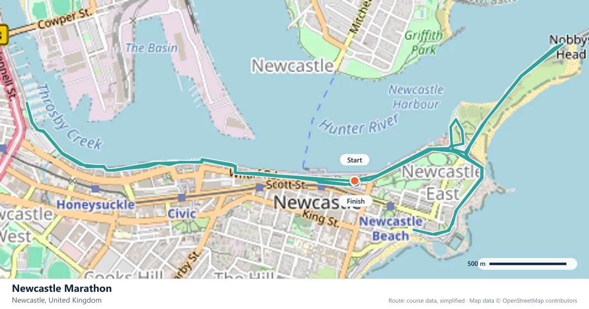
Where does the Newcastle Marathon run?
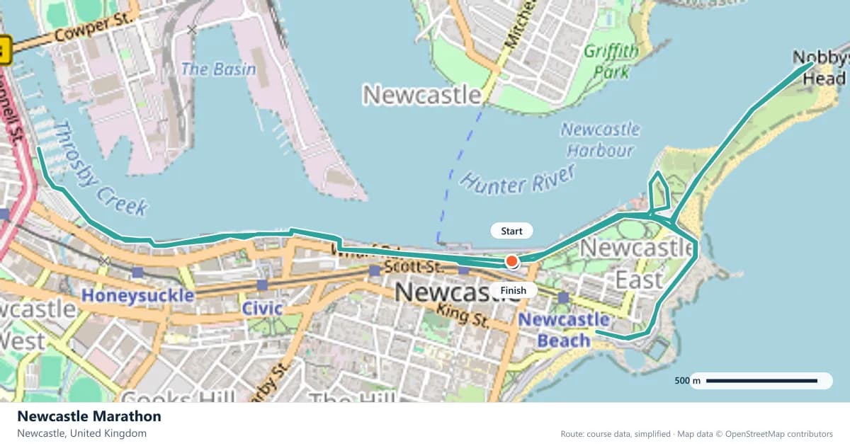
Interactive map
The trace follows the organizer's published course, simplified for the screen: the orange dot is the start, the dark dot the finish. Scroll to zoom, drag to pan.
What is the Newcastle Marathon course like?
A spring city marathon on Tyneside, with the Tyne bridges and the Quayside forming the backdrop. Flat, quick roads and a field drawn from across the north-east.
- Next edition
- May 2027 (expected)
- Elevation gain
- 74 m
- Profile
- Flat
- First run
- —
Course guide
Newcastle's marathon runs through a city defined by its river crossings. The Tyne bridges and the Quayside form the backdrop, and the course is flat and quick. The next edition is expected in May 2027.
The gain is about 74 metres over 42.195 km, which is low even for a city marathon. The roads are flat, the field is drawn from across the north-east, and the race has the feel of a regional event with a big-city setting.
That combination makes it approachable: a flat course, a compact city and a spring date. The river gives the race its shape, and the city gives it a crowd. But flat does not mean easy, and the main challenge is the pace you choose in the first half.
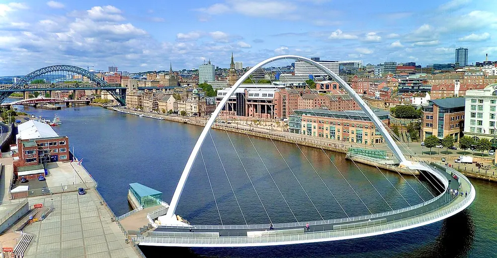
Newcastle-upon-Tyne-bridges-and-skyline cropped. Photo: JimmyGuano / Wikimedia Commons, CC BY-SA 4.0.
The course
The route runs on flat, quick roads through Newcastle and along the Tyne, with the bridges and the Quayside providing the backdrop. The climbing total is about 74 metres, so there is no section that demands a change of stride.
Because the course is effectively flat, the main challenge is the pace you choose rather than the terrain. The roads are fast, and it is easy to go out harder than planned.
The bridges and the Quayside
Newcastle's riverfront is one of the most recognisable in Britain: the Tyne Bridge, the Swing Bridge, the Millennium Bridge, and the Quayside running beneath them. The race uses that setting as its stage, and the crossings give the route its landmarks. The Quayside is the city's front door, a stretch of riverside walks, bars and bridges that frames the race.
The bridges are also a reminder of the city's history. The Tyne was a working river, and the Quayside was at the centre of the coal trade. The race runs through a landscape that has been rebuilt around its river. The Tyne is tidal through the city, and the bridges cross the river in quick succession, which gives the Quayside its enclosed, urban feel. The Tyne Bridge is the symbol of the city, and seeing it from the course is one of the race's memorable moments.
On race day, the bridges are where crowds gather and where the course feels most urban. Use the noise, but keep your pace.
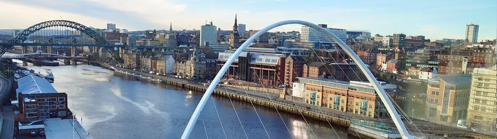
Newcastle-upon-Tyne-bridges-and-skyline panorama. Photo: JimmyGuano / Wikimedia Commons, CC BY-SA 4.0.
Flat roads, honest pacing
With 74 metres of climbing, there is nothing to slow the pace except the pace itself. The flat roads invite a fast start, and the field can pull you along. Resist the urge to bank time in the first 10 km.
Run by effort and let the flat kilometres come. A course this level rewards patience at the back end, not heroics at the front. The low gain means the race is decided by pacing and fuelling discipline rather than climbing strength.
A north-east field
The field is drawn from across the north-east of England, which gives the race a strong regional identity. It is a city marathon with a local heart: clubs from across the region make the race their own, and visitors get to see a part of England that is often passed by.
For visitors, that means a friendly, unpretentious atmosphere rather than a major-city circus. The support is concentrated in the centre and along the Quayside, and it feels personal.
An expected May date
May 2027 is expected but not confirmed. The spring date fits a winter build, and the flat course is a good target for a first marathon. Check the organiser's schedule before booking travel.
The city centre is compact, with the Quayside, the station and the main streets close together, which keeps race weekend manageable. That is a luxury on a marathon trip.
Frequently asked questions
Answers to the questions runners ask before entering, drawn from this race's course guide and the directory's own data — the sources behind them are listed below.
When is the Newcastle Marathon?
The next edition is expected in May 2027. The spring date is not yet confirmed, so check the organiser's schedule before making plans.
Is the Newcastle Marathon flat?
Yes. The course climbs about 74 metres across the full distance, which is a low total for a city marathon. The roads are flat and quick, with the Tyne bridges and Quayside as the backdrop.
Is Newcastle suitable for a first marathon?
Yes. The flat, quick roads and modest climbing make it a sensible first attempt, provided you prepare for the distance rather than the terrain. The expected May date also fits a spring build.
Is it a fast course?
The profile is flat, with only 74 metres of climbing, so there is little to slow you down. Whether that turns into a fast time depends on the day and on how you pace it.
Where is the Newcastle Marathon run?
It is run on Tyneside, in and around Newcastle, with the Tyne bridges and the Quayside in view. The course uses flat city roads.
Is the Newcastle Marathon a regional race?
The field is drawn from across the north-east of England, giving the race a strong regional identity. The course is a city marathon on Tyneside, with the Tyne bridges and Quayside as its backdrop.
More marathons in United Kingdom
More marathons in Europe
Sources for this page
What each source below is used for on this page, and where to check this race yourself.
- World Athletics — the label calendar and the road-race regulations. Used to check whether the race holds a World Athletics label, and its elite competition details.
- AIMS — the international course-measurement standard behind the 42.195 km distance, and the AIMS race calendar.
- The organizer's own publications — course maps, race handbooks and published results. The date, course character and climbing on this page are compiled from them and re-checked each season.
Where do these facts come from?
Dates, course type, climbing and time limits are compiled from the organizer's publications and re-checked each season; elevation is an estimate of total climbing rather than a survey figure. Always confirm race-day details with the organizer before making plans.
Last reviewed 27 October 2026