
Snowdonia Marathon
The Snowdonia Marathon starts and finishes in Llanberis, at the foot of Snowdon, and spends the miles between them on mountain roads. The next edition is expected in October 2027.
By Global Marathon Routes editorial team · Last reviewed 27 October 2026
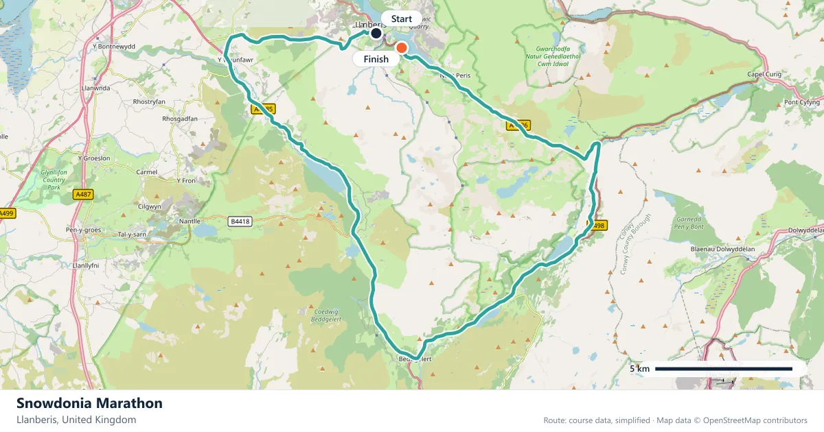
Where does the Snowdonia Marathon run?
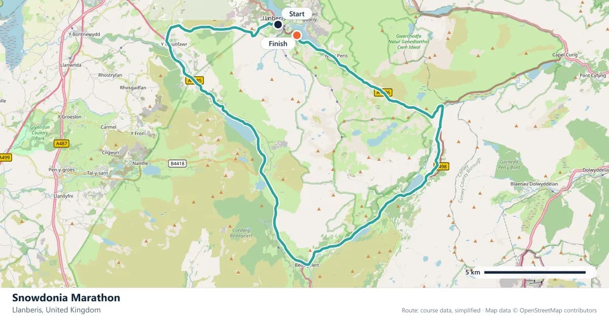
Interactive map
The trace follows the organizer's published course, simplified for the screen: the orange dot is the start, the dark dot the finish. Scroll to zoom, drag to pan.
What is the Snowdonia Marathon course like?
A mountain-road marathon out of Llanberis at the foot of Snowdon, with around 750 metres of climbing packed into one lap of the national park. Weather and terrain decide the day.
- Next edition
- October 2027 (expected)
- Elevation gain
- 750 m
- Profile
- Hilly
- First run
- —
Course guide
The Snowdonia Marathon starts and finishes in Llanberis, at the foot of Snowdon, and spends the miles between them on mountain roads. The next edition is expected in October 2027. The course is one lap of the national park with about 750 metres of climbing, and the weather can change the day as much as the terrain.
Llanberis is a village of slate and water, set between Llyn Padarn and the slopes of Snowdon. The race uses that landscape directly: the roads are real roads, but the gradients, the exposure and the mountain weather are not those of a city course.
The 750 metres are the headline. They are packed into a single lap, and the descents are as demanding as the climbs. This is a race where time goals are secondary to finishing well. The start and finish in the village are the calm bookends to a long day in the mountains.
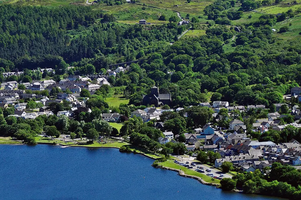
Pentref Llanberis a Llyn Padarn. Photo: Hefin Owen from Wales / Wikimedia Commons, CC BY-SA 2.0.
The course
The route is a single lap through the national park, based out of Llanberis. With about 750 metres of climbing, it is a mountain-road marathon in more than name: the surface is tarmac, but the gradients and the weather are not those of a city course.
The course is a loop, and the terrain is the point: mountain roads, weather and 750 metres of ascent make this a very different proposition from a city marathon.
Mountain roads
The roads around Snowdon are narrow, exposed and steep in places. The route climbs away from the lake and into the high ground, where the road twists between slate walls and open moorland. The climbing is sustained, not a series of rollers, and the descents are fast and hard on the quads, especially late in the race.
There is little chance to settle into a flat rhythm, so the race becomes a long series of efforts. Train on long climbs and practise descending. The course rewards strength and control more than raw speed, and the mountain does not care about your goal time.
Mountain weather
Mountain weather can change through the day and shape the result as much as the terrain does. On the higher ground, conditions can shift quickly, and the difference between the valley and the exposed sections is significant. Check the forecast and prepare for a range.
Carry what you need and be ready to adjust your goals. On a mountain course, flexibility is part of the preparation.
A first marathon with a mountain attached
The race is open to a first marathon, and the distance is the same 42.195 km as anywhere else. The difference is 750 metres of climbing and the mountain conditions. A first marathon here is realistic only with hill training, honest pacing and a willingness to let the clock go. The key is to run within yourself on the climbs and to treat the descents as part of the race rather than a recovery.
Treat it as a mountain day that happens to be a marathon, not a city race with extra hills. That mindset will serve you better than any split target.
The village and the lake
Llanberis sits at the foot of Snowdon, with Llyn Padarn stretching away and the slate quarries of the area shaping the landscape. The slate industry built the village, and the old workings are still part of the hills above it. The village is small, and the race fills it.
The setting is part of the appeal: the lake, the mountain and the sense of being in a real place rather than a city loop. The lake and the mountain are visible from much of the village, which makes the finish easy to remember. The finish back in the village is a proper homecoming.
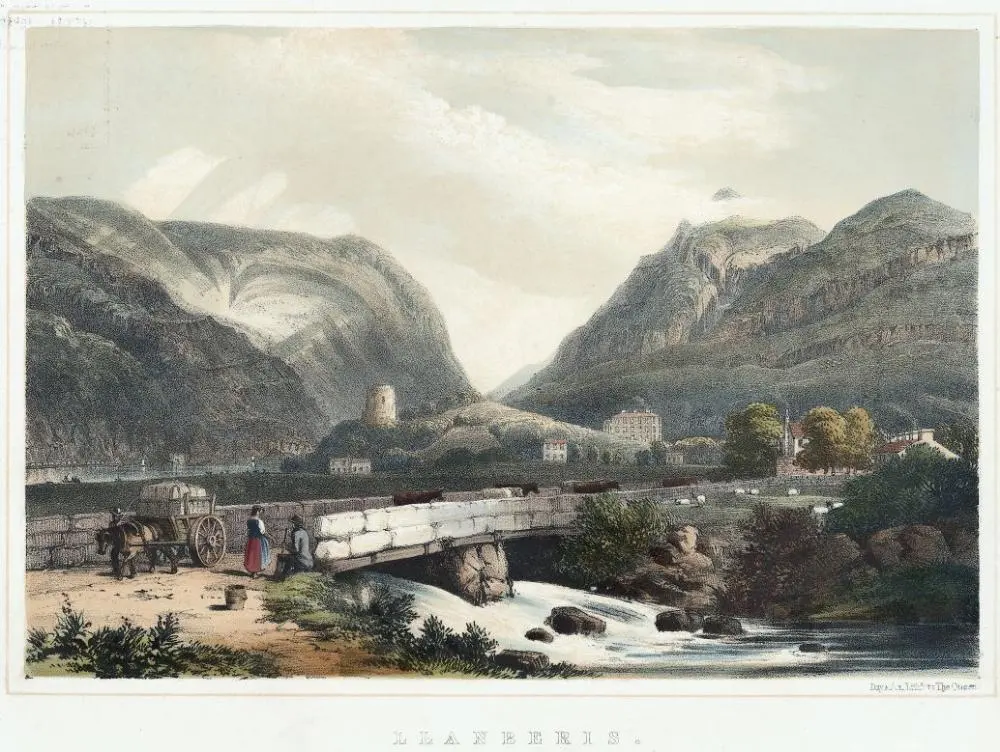
Llanberis. Photo: Day & Son. Lithr. to the Queen, engraver. / Wikimedia Commons, CC0.
Frequently asked questions
Answers to the questions runners ask before entering, drawn from this race's course guide and the directory's own data — the sources behind them are listed below.
When is the Snowdonia Marathon?
The next edition is expected in October 2027. It is a late-autumn mountain-road race based in Llanberis.
Is the Snowdonia Marathon hilly?
Yes. It climbs about 750 metres in a single lap of the national park. That is a significant amount of ascent, and the mountain roads make the course far hillier than a typical city marathon.
Is it suitable for a first marathon?
It can be, but the climbing and mountain conditions make it a demanding first marathon. A first-timer needs hill training and realistic expectations, not just flat long runs.
Is it a personal-best course?
No. With about 750 metres of climbing and mountain weather, it is not a course for fast times. It is a race to finish well and enjoy the terrain.
Where is the Snowdonia Marathon run?
It is run from Llanberis, at the foot of Snowdon, on one lap through the national park. The course is a mountain-road loop rather than a city circuit.
What makes the Snowdonia Marathon different?
The combination of about 750 metres of climbing, mountain roads and weather that can change the day. It is a race where the terrain and conditions, rather than the clock, set the agenda.
More marathons in United Kingdom
More marathons in Europe
Sources for this page
What each source below is used for on this page, and where to check this race yourself.
- World Athletics — the label calendar and the road-race regulations. Used to check whether the race holds a World Athletics label, and its elite competition details.
- AIMS — the international course-measurement standard behind the 42.195 km distance, and the AIMS race calendar.
- The organizer's own publications — course maps, race handbooks and published results. The date, course character and climbing on this page are compiled from them and re-checked each season.
Where do these facts come from?
Dates, course type, climbing and time limits are compiled from the organizer's publications and re-checked each season; elevation is an estimate of total climbing rather than a survey figure. Always confirm race-day details with the organizer before making plans.
Last reviewed 27 October 2026