
Porto Alegre Marathon
Twenty-eight metres of climbing across 42.195 km is about as close to level as a marathon gets. Porto Alegre's race follows the Guaíba waterfront and threads through the city's parks, and the 2027…
By Global Marathon Routes editorial team · Last reviewed 27 October 2026
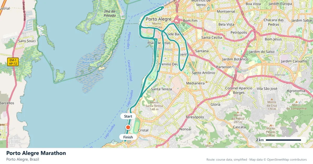
Where does the Porto Alegre Marathon run?
Interactive map
The trace follows the organizer's published course, simplified for the screen: the orange dot is the start, the dark dot the finish. Scroll to zoom, drag to pan.
What is the Porto Alegre Marathon course like?
A very flat southern Brazilian marathon along the Guaíba waterfront and through the city's parks. Twenty-eight metres of climbing in total, and cool autumn conditions.
- Next edition
- May 2027 (expected)
- Elevation gain
- 28 m
- Profile
- Flat
- First run
- —
Course guide
Twenty-eight metres of climbing across 42.195 km is about as close to level as a marathon gets. Porto Alegre's race follows the Guaíba waterfront and threads through the city's parks, and the 2027 edition is expected in May, in the southern autumn. The route is flat, the air should be cool, and the setting gives the race a calmer character than Brazil's bigger city marathons.
The Guaíba is the defining feature. Porto Alegre grew along the water, and the waterfront remains the city's front room, with the skyline rising behind it and the sun setting across the bay. The race uses that edge, then turns inland through green space before returning to the water.
For runners chasing a time, the appeal is obvious: there is almost nothing on the course to interrupt a steady rhythm. The challenge is not the terrain but the discipline of running evenly when every kilometre feels easy.
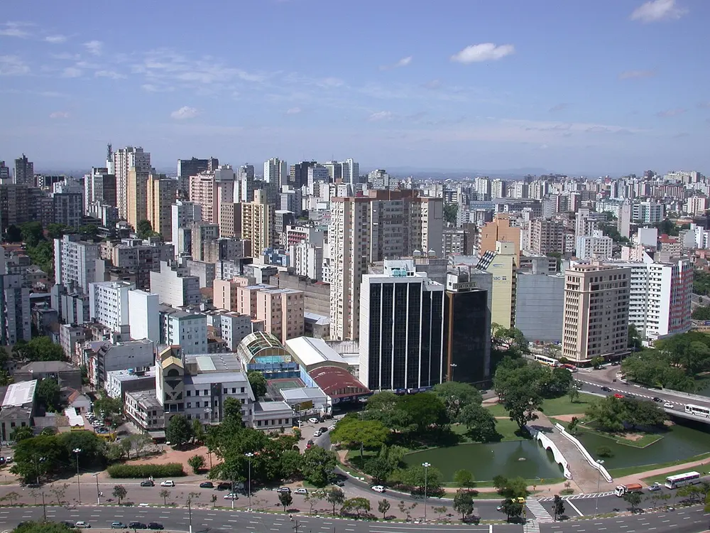
Porto Alegre skyline. Photo: No machine-readable author provided. Adreson~commonswiki assumed (based on copyright claims). / Wikimedia Commons, CC BY 2.5.
The course
The route runs along the Guaíba waterfront and through Porto Alegre's parks, with very little climbing to interrupt the rhythm. The waterfront provides the long, open stretches; the parks add shade, turns and a change of scene. The race stays within the city rather than heading into open country.
The flat profile does not mean the course is featureless. The waterfront is exposed to the sky and the water, while the parks bring narrower paths and more frequent changes of direction. That contrast is useful: it breaks the race into manageable pieces without adding any real ascent.
The Guaíba waterfront
The Guaíba is a broad body of water at the city's edge, wide enough that the far shore feels distant and the sunsets become an event. The waterfront is Porto Alegre's public space, with promenades, old industrial buildings and places to stop and look across the water.
On race day, the waterfront gives the course its sense of scale. The skyline sits behind the runners, the water opens to one side, and the kilometres pass without the usual city interruptions. It is the part of the route that feels most like Porto Alegre.
Parks and the long rhythm
Porto Alegre is a green city, and its parks are part of the city's identity. The marathon uses them as a counterpoint to the waterfront, replacing open water with trees, lawns and the enclosed feeling of a park path.
That shift matters late in the race. When the legs are tired, a park can feel either welcoming or repetitive, depending on how the day is going. Runners who know the route can use each section as a marker, breaking the marathon into smaller pieces rather than one long flat effort.
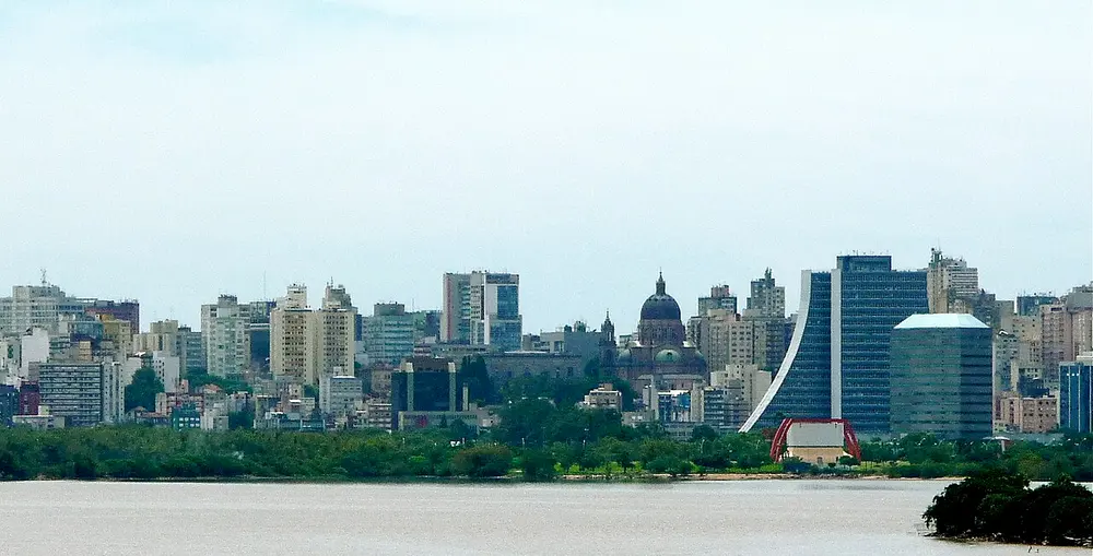
Porto Alegre Skyline. Photo: (WT-shared) Ricardo Rmx / Wikimedia Commons, CC BY-SA 3.0.
What 28 metres means
A flat course is not an easy course. With only about 28 metres of climbing, the muscles stay in the same position for kilometre after kilometre, and the lack of variation can be its own kind of fatigue. The pace feels sustainable early, which is exactly when the race is most likely to be lost.
The solution is patience. Run the first half at the speed you have planned, not the speed the course invites, and use the parks and the waterfront as rhythm markers. The course rewards runners who can hold form when there is no hill to break the effort. This is a personal-best course for runners who respect it, not for those who race the first 10 km.
Autumn in the south
May is autumn in Porto Alegre, and the season is the reason the race can be run at a sensible pace. The southern Brazilian summer is hot and humid; by May the worst of it has passed, and the mornings are cooler. The date is expected rather than confirmed, so the exact weekend should be checked before booking travel.
The city also feels different in autumn. The parks are quieter, the light is softer, and the waterfront is more likely to be a place for running than for hiding from the sun. For a marathon, that is a welcome combination.
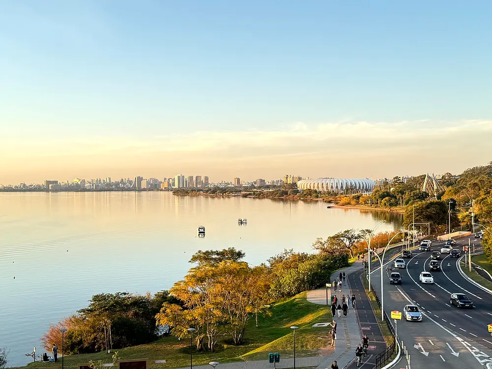
Skyline Porto Alegre, Rio Grande do Sul 2026. Photo: Pedu0303 / Wikimedia Commons, CC0.
Frequently asked questions
Answers to the questions runners ask before entering, drawn from this race's course guide and the directory's own data — the sources behind them are listed below.
When is the Porto Alegre Marathon?
The 2027 edition is expected in May, in the southern autumn. The exact date has not been confirmed, so check the organiser's information before making travel plans.
Is the Porto Alegre Marathon flat?
Yes. The course climbs only about 28 metres in total, which is very close to level. The waterfront and park sections are both flat, and there is no sustained ascent anywhere on the route.
Is the Porto Alegre Marathon good for a personal best?
It is a personal-best course, provided you pace it sensibly. The flat profile removes the terrain obstacle, but the lack of variation can tempt runners into going out too quickly.
Where is the Porto Alegre Marathon run?
It is run in Porto Alegre, in southern Brazil, along the Guaíba waterfront and through the city's parks.
Why is the race held in May?
May is autumn in southern Brazil, when conditions are cooler than in the summer months. The date is expected rather than confirmed for 2027.
What is the waterfront like?
The Guaíba waterfront is broad, open and central to the city's identity, with the skyline behind it and long views across the water. It provides the course's most distinctive stretches.
Are the parks a significant part of the course?
Yes. The route moves between the waterfront and the city's parks, which add turns, shade and a change of rhythm without adding meaningful climbing.
More marathons in Brazil
More marathons in Americas
Sources for this page
What each source below is used for on this page, and where to check this race yourself.
- World Athletics — the label calendar and the road-race regulations. Used to check whether the race holds a World Athletics label, and its elite competition details.
- AIMS — the international course-measurement standard behind the 42.195 km distance, and the AIMS race calendar.
- The organizer's own publications — course maps, race handbooks and published results. The date, course character and climbing on this page are compiled from them and re-checked each season.
Where do these facts come from?
Dates, course type, climbing and time limits are compiled from the organizer's publications and re-checked each season; elevation is an estimate of total climbing rather than a survey figure. Always confirm race-day details with the organizer before making plans.
Last reviewed 27 October 2026