
Thessaloniki Marathon
Thessaloniki's marathon runs with the sea on one side and the city on the other. The route follows the waterfront past the White Tower and out towards the old walls, and the next edition is expected…
By Global Marathon Routes editorial team · Last reviewed 27 October 2026
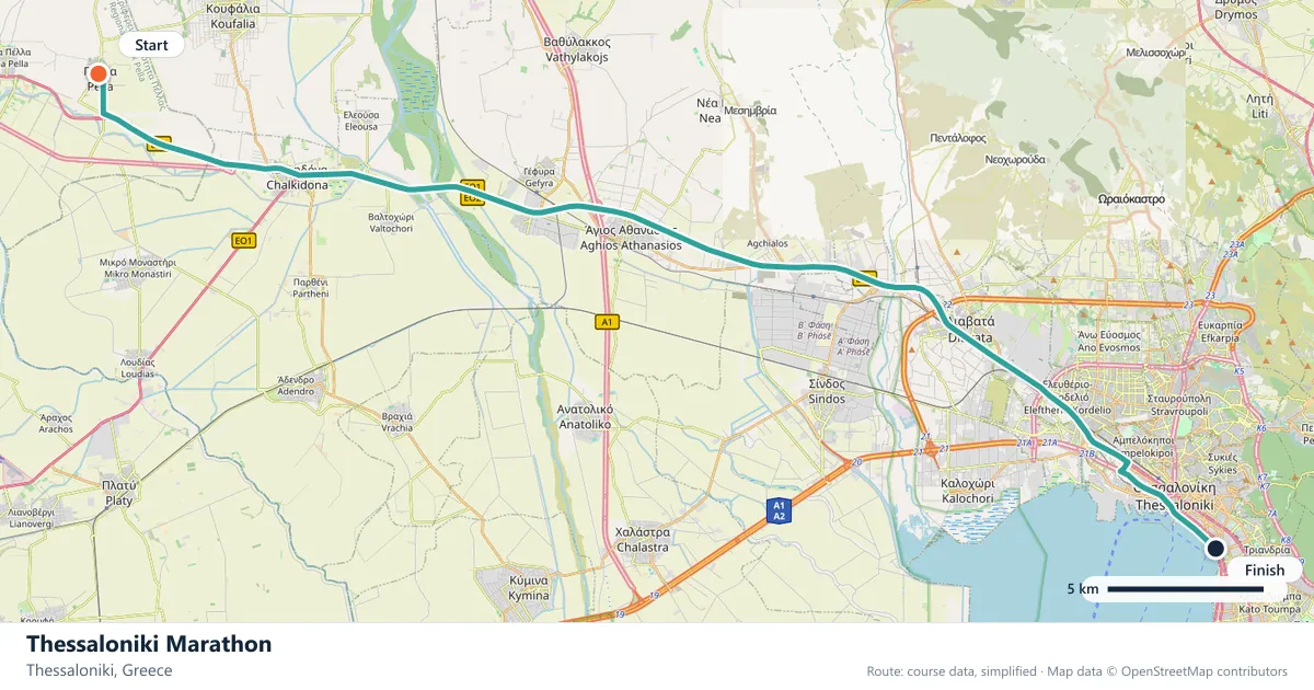
Where does the Thessaloniki Marathon run?
Interactive map
The trace follows the organizer's published course, simplified for the screen: the orange dot is the start, the dark dot the finish. Scroll to zoom, drag to pan.
What is the Thessaloniki Marathon course like?
A spring marathon along the Thessaloniki waterfront, past the White Tower and out towards the old city walls. Sea-level and mostly flat, with a few rises near the turnaround.
- Next edition
- April 2027 (expected)
- Elevation gain
- 117 m
- Profile
- Undulating
- First run
- —
Course guide
Thessaloniki's marathon runs with the sea on one side and the city on the other. The route follows the waterfront past the White Tower and out towards the old walls, and the next edition is expected in April 2027. The profile is undulating, with about 117 metres of climbing, but most of it is close to level and the whole course sits at sea level.
That combination makes the race a spring outing with a bit of bite. The waterfront provides the long, open kilometres; the upper city provides the rises. It is a different kind of Greek race from Athens: a city marathon beside the Thermaic Gulf rather than a pilgrimage from Marathon.
Thessaloniki is a city of layers, Roman, Byzantine and Ottoman, and the race passes enough of them to make the morning feel like more than a training run. The White Tower is the emblem, but the old walls and the dense streets behind the waterfront do just as much to give the course its character.
The course
The race follows the Thessaloniki waterfront, with the sea on one side and the city on the other. The White Tower is the best-known landmark, and the route continues out towards the old city walls before turning back along the coast.
At about 117 metres of gain, the course is close to flat for most of its length. The short rises near the turnaround are the exception, and they arrive when the race starts to hurt. The flat waterfront makes it easy to arrive there ahead of schedule, so the middle kilometres need to be controlled rather than celebrated.
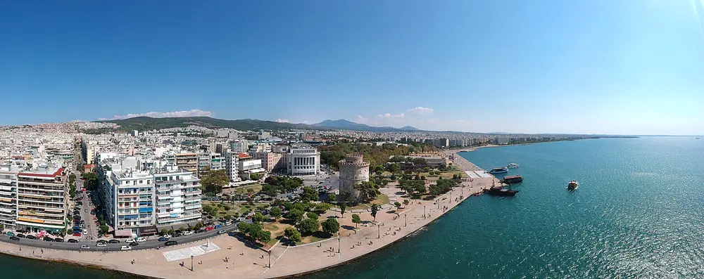
Thessaloniki beach promenade. Photo: Johannesjom / Wikimedia Commons, CC BY-SA 4.0.
The White Tower and the waterfront
The White Tower is the image most people carry of Thessaloniki: a cylindrical Ottoman tower on the seafront, rebuilt and renamed over the centuries, now standing at the centre of the city's long promenade. The marathon passes it, and for a few kilometres the race has the feel of a seaside event.
The waterfront is where Thessaloniki comes to walk, run and sit in the evening. On race morning it gives the field room to spread out, with the gulf on one side and the city on the other. The flatness is real, but the exposure is too: there is little shelter on the seaward side, and the open air can make the effort feel different from the calm of the streets.
It is a section to enjoy without racing it. The tower, the promenade and the water are the reward for the early start.
The old walls and the turnaround
The route turns inland towards the old city walls, where the ground begins to rise. Ano Poli, the upper town, still carries stretches of the Byzantine fortifications, and the streets below them are among the steepest in Thessaloniki.
The climbs near the turnaround are short, but they are the only real gradients on the course, and they arrive at the least convenient moment. Runners who spent the waterfront kilometres at a flat-course pace will feel them; runners who held back will merely notice them.
The return to the coast is faster, and the final kilometres retrace the promenade. By then the White Tower is a finish-line marker rather than a sightseeing stop.
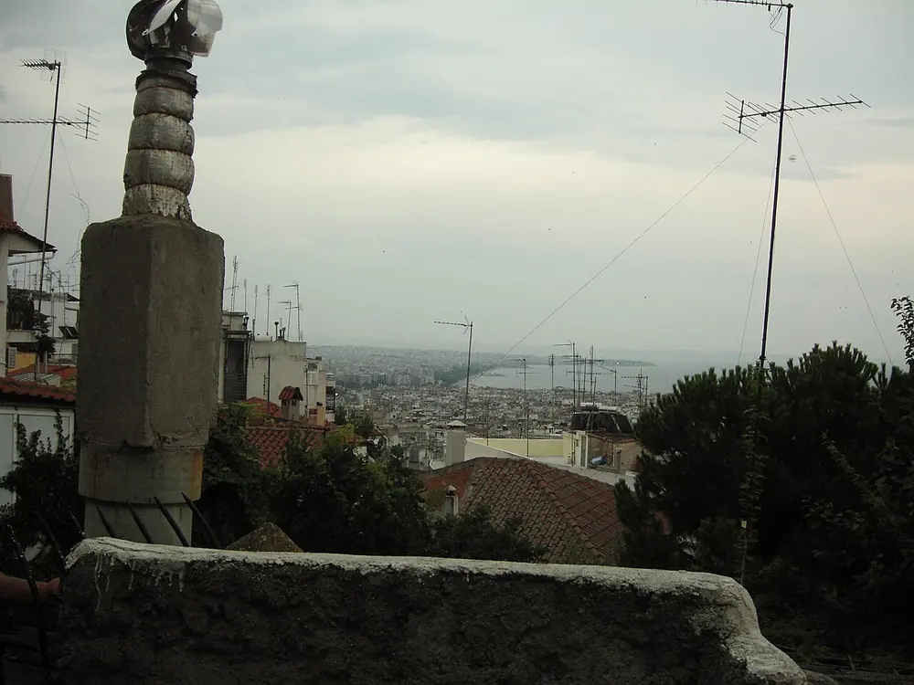
2006 July 30, Thessaloniki 3. Photo: Syced / Wikimedia Commons, CC0.
A spring race beside the Thermaic Gulf
April 2027 is expected rather than confirmed, so check the organiser's announcement before locking in travel. The spring date suits a city that is comfortable in the water-adjacent months, and the sea-level course means there is no altitude to factor into the plan.
Thessaloniki itself is a good place to spend a weekend. The Aristotelous Square looks out over the gulf, the markets are lively, and the food is a reason to stay an extra day. On clear days the shape of Mount Olympus shows across the water, which is a reminder of how close the city sits to the mountains without having to run up any of them.
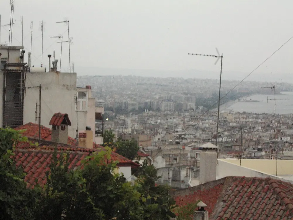
2006 July 30, Thessaloniki 5. Photo: Syced / Wikimedia Commons, CC0.
Frequently asked questions
Answers to the questions runners ask before entering, drawn from this race's course guide and the directory's own data — the sources behind them are listed below.
When is the Thessaloniki Marathon?
The next edition is expected in April 2027. The date is provisional, so check the organiser's information before finalising plans.
Is the Thessaloniki Marathon flat or hilly?
It is mostly flat, with about 117 metres of climbing and an undulating classification. The few rises arrive near the turnaround, and the course is at sea level.
Where is the Thessaloniki Marathon run?
It is run in Thessaloniki along the city's waterfront. The route passes the White Tower and continues out towards the old city walls before returning along the coast.
Is the date confirmed?
No. April 2027 is the expected month, not a confirmed race day. The organiser publishes the final date and start times closer to the event.
What is the toughest part of the course?
The rises near the turnaround are the main difficulty. They are short, but they arrive after a long flat stretch, when the legs are already working, and the return along the waterfront still has to be run.
Is there a hill to train for?
No single hill defines the race. The training priority is the flat distance plus enough rolling ground to handle the short climbs near the turnaround.
More marathons in Greece
More marathons in Europe
Sources for this page
What each source below is used for on this page, and where to check this race yourself.
- World Athletics — the label calendar and the road-race regulations. Used to check whether the race holds a World Athletics label, and its elite competition details.
- AIMS — the international course-measurement standard behind the 42.195 km distance, and the AIMS race calendar.
- The organizer's own publications — course maps, race handbooks and published results. The date, course character and climbing on this page are compiled from them and re-checked each season.
Where do these facts come from?
Dates, course type, climbing and time limits are compiled from the organizer's publications and re-checked each season; elevation is an estimate of total climbing rather than a survey figure. Always confirm race-day details with the organizer before making plans.
Last reviewed 27 October 2026