
Medellín Marathon
Medellín runs up both sides of its river. The marathon follows the city through the Aburrá valley, climbing on either side of the water, and the 2027 edition is expected in September.
By Global Marathon Routes editorial team · Last reviewed 27 October 2026
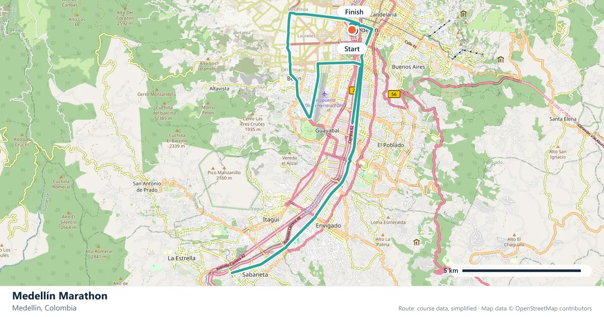
Where does the Medellín Marathon run?
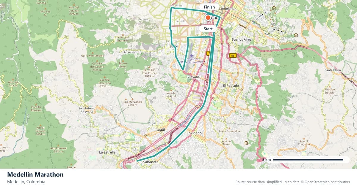
Interactive map
The trace follows the organizer's published course, simplified for the screen: the orange dot is the start, the dark dot the finish. Scroll to zoom, drag to pan.
What is the Medellín Marathon course like?
Runs through Colombia's second city in the Aburrá valley, climbing on both sides of the river. Warm, hilly and one of the best-supported races in South America.
- Next edition
- September 2027 (expected)
- Elevation gain
- 237 m
- Profile
- Undulating
- First run
- —
Course guide
Medellín runs up both sides of its river. The marathon follows the city through the Aburrá valley, climbing on either side of the water, and the 2027 edition is expected in September. Colombia's second city is warm, steep and loud, and the race is one of the best supported in South America.
The profile is undulating, with about 237 metres of climbing. There is no single mountain ascent, but the course is never flat for long: it rises from the river into the neighbourhoods and returns, repeatedly. The warmth adds to the cost of every climb, and the crowds add something else entirely.
This is a marathon with a strong sense of place. The valley setting, the hillside barrios and the constant noise give it a character that is very different from a flat capital-city loop, and the course uses the terrain rather than avoiding it.
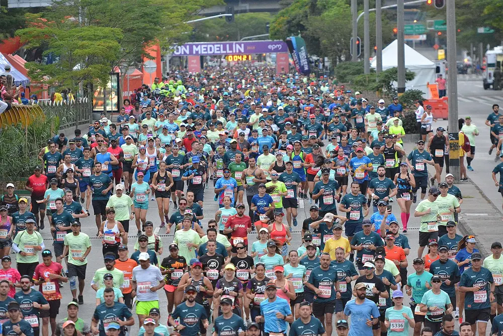
Maratón Medellín 2019. Photo: Molowikico / Wikimedia Commons, CC BY-SA 4.0.
The course
The route works through Medellín's urban grid on both sides of the river, using the valley's slopes to accumulate about 237 metres of climbing. The terrain is undulating rather than mountainous, but the climbs are persistent, and the warm conditions make them feel longer than their gradients suggest.
There is no single ascent that defines the race. The challenge is cumulative: a series of rises and descents that never quite lets the legs settle. Runners who are used to rolling terrain will find a rhythm; those who have only raced flat courses should add hill work before toeing the line.
The Aburrá valley
Medellín sits in a narrow valley, with the river running through the bottom and the city climbing the sides. The result is a metropolis of slopes and steps, where neighbourhoods at different heights have different views and different weather. The metrocable, the cable-car system that links the hillside comunas to the metro, has become a symbol of the city's geography.
The marathon uses that shape. Roads rise from the river and return, and the course is always aware of the valley walls. The setting gives the race its character: this is not a city that can pretend to be flat.
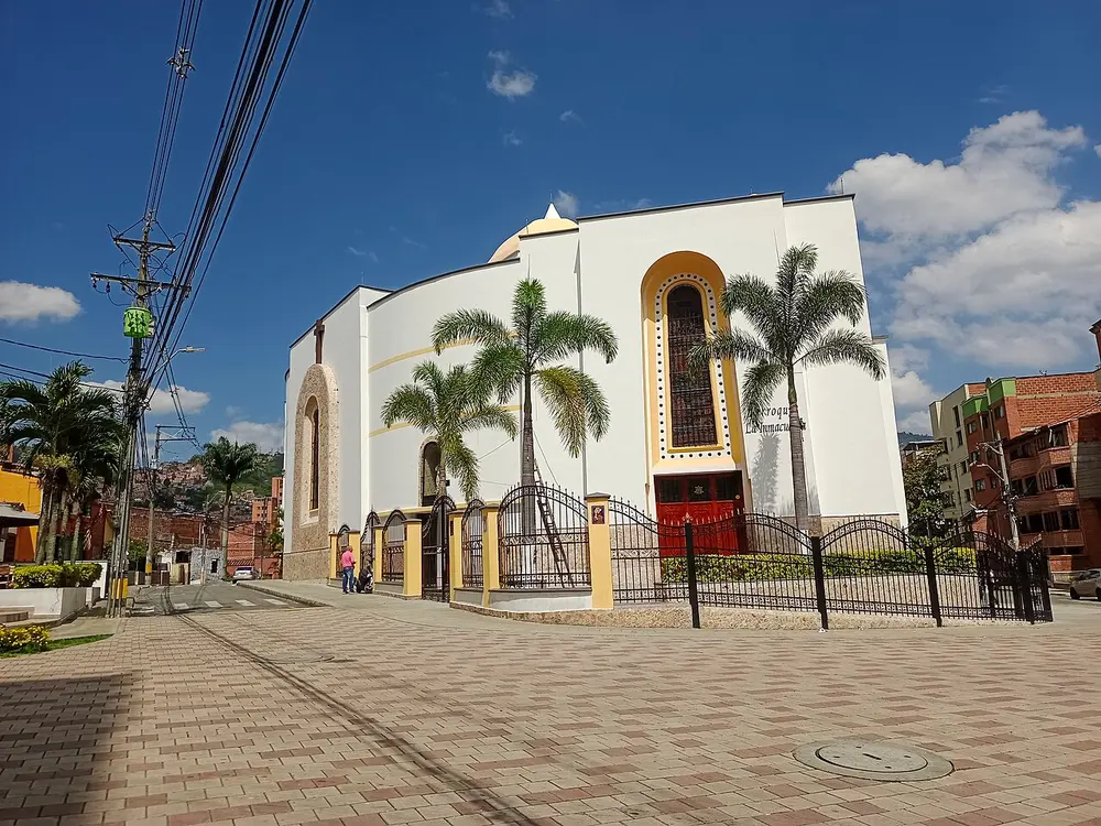
Iglesia de la Inmaculada Concepción, Medellín - fachada. Photo: XalD / Wikimedia Commons, CC BY-SA 4.0.
The crowds
Medellín's marathon is one of the best-supported races in South America. Crowds line the route, music spills out of the neighbourhoods, and the city treats the race as an event rather than a closed-road inconvenience. On the climbs, the support can be the difference between holding pace and walking.
The noise is also a trap. It is easy to run faster than planned when the crowd is urging you on, especially in the early kilometres. The best runners use the energy without letting it dictate the pace.
Warmth and repeated climbing
The warmth is the race's quiet difficulty. Medellín's climate is mild by Colombian standards, but it is still warm enough that hydration and cooling matter, and the hills multiply the effect. A rise that would be manageable in cool air becomes a negotiation in the heat.
The practical approach is to start conservatively and treat the first half as a long approach. Drink early, use the descents to recover and do not chase splits on the climbs. The second half of this course is where the cumulative climbing shows.
A race that rewards experience
Medellín is not a course that flatters a debutant or a personal-best attempt. The warm valley and the repeated climbing make it a demanding day, and the crowds can pull an inexperienced runner into an unsustainable pace. Runners with marathon experience are more likely to enjoy it.
What the race offers instead is atmosphere and authenticity. The valley, the barrios, the metrocable and the crowds make it a memorable city marathon, and the course is a genuine tour of Medellín rather than a loop around its edges. It is a race to run for the experience.
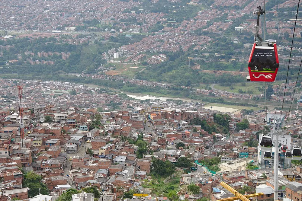
Metrocable and Comuna 1 in Medellín 01. Photo: JoranL / Wikimedia Commons, CC BY-SA 4.0.
Frequently asked questions
Answers to the questions runners ask before entering, drawn from this race's course guide and the directory's own data — the sources behind them are listed below.
When is the Medellín Marathon?
The 2027 edition is expected in September. The date is not yet confirmed, so check the organiser's information before making travel plans.
Is the Medellín Marathon flat or hilly?
It is undulating, with about 237 metres of climbing. The course climbs on both sides of the river, so it is not flat, even though there is no single mountain ascent.
Is Medellín a good first marathon or personal-best course?
Neither goal is the race's strength. The warm conditions and persistent climbing make it a demanding debut and a difficult place to chase a fast time. Runners with marathon experience are likely to enjoy it more.
Where is the Medellín Marathon run?
It runs through Medellín, Colombia, in the Aburrá valley, on both sides of the river.
What is the atmosphere like?
It is one of the best-supported races in South America. Crowds line the route, music fills the neighbourhoods and the city treats the marathon as a big event.
Why is the course so demanding?
The route climbs repeatedly on both sides of the valley, and the warmth adds to the effort. The climbing is cumulative rather than concentrated, so there is no single section where the work ends.
More marathons in Americas
Sources for this page
What each source below is used for on this page, and where to check this race yourself.
- World Athletics — the label calendar and the road-race regulations. Used to check whether the race holds a World Athletics label, and its elite competition details.
- AIMS — the international course-measurement standard behind the 42.195 km distance, and the AIMS race calendar.
- The organizer's own publications — course maps, race handbooks and published results. The date, course character and climbing on this page are compiled from them and re-checked each season.
Where do these facts come from?
Dates, course type, climbing and time limits are compiled from the organizer's publications and re-checked each season; elevation is an estimate of total climbing rather than a survey figure. Always confirm race-day details with the organizer before making plans.
Last reviewed 27 October 2026