
Brasilia Marathon
多坡 course in Brasilia, 巴西 with about 256 m of climbing. Next edition April 2027 (expected).
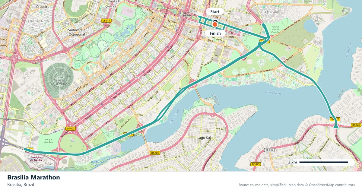
Where does the Brasilia Marathon run?
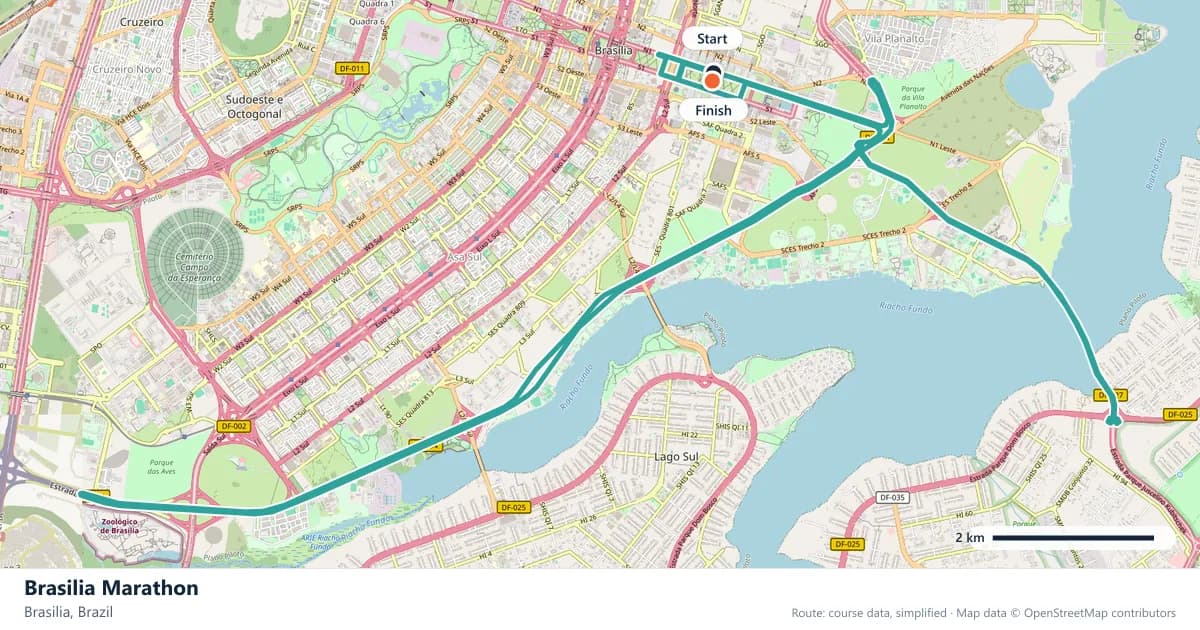
Interactive map
The trace follows the organizer's published course, simplified for the screen: the orange dot is the start, the dark dot the finish. Scroll to zoom, drag to pan.
What is the Brasilia Marathon course like?
A loop through the planned capital's monument axis and along Lake Paranoá, on a course hillier than its modernist setting suggests. Wide roads and dry winter air.
- Next edition
- April 2027 (expected)
- Elevation gain
- 256 m
- Profile
- 多坡
- First run
- —
Frequently asked questions
Short answers computed from the directory's own data — the race date, the course profile and the climbing — with the sources for each given below.
When is the next Brasilia Marathon?
- The next edition is expected in April 2027: the organizer had not published an exact race day when this page was last reviewed, so treat it as a window rather than a fixed date.
How hilly is the Brasilia Marathon course?
- The directory classifies the course as 多坡, with about 256 m of total climbing across the 42.195 km. The figure is an estimate of climbing, not a survey measurement.
Is the Brasilia Marathon a fast course?
- The directory flags it as a personal-best course, which is why it appears in the flattest-first sort: the climbing is modest for a city marathon. It is a course rating from this directory, not an official measurement.
More marathons in 巴西
More marathons in Americas
Sources for this page
What each source below is used for on this page, and where to check this race yourself.
- World Athletics — the label calendar and the road-race regulations. Used to check whether the race holds a World Athletics label, and its elite competition details.
- AIMS — the international course-measurement standard behind the 42.195 km distance, and the AIMS race calendar.
- The organizer's own publications — course maps, race handbooks and published results. The date, course character and climbing on this page are compiled from them and re-checked each season.
Where do these facts come from?
Dates, course type, climbing and time limits are compiled from the organizer's publications and re-checked each season; elevation is an estimate of total climbing rather than a survey figure. Always confirm race-day details with the organizer before making plans.
Last reviewed 14 October 2026